 |
||
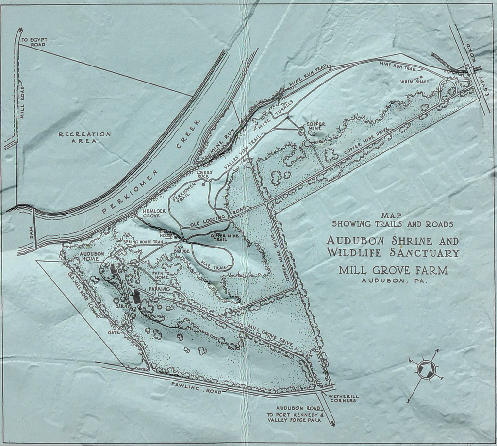
| Montgomery
County purchased Mill Grove in 1951. This map (sans the LIDAR-derived
3D terrain) lacks a date but seems to have been prepared around that
time. Present-day maps don't show the two mine entrances (labeled "mine tunnels") along Mine Run (the mine entrances are now sealed by iron grates). The County gave the piece of land that accessed Egypt Road to a developer who built houses on it during the 1980s. Click on the map to view it without the LIDAR-derived 3D terrain. The village of Shannonville was re-named Audubon in 1899 after the circulation of a petition that was signed by a hundred persons. Not everyone thought the name change a good idea, however. Follow this link to an 1899 letter-to-the-editor. Follow this link to an 1882 article about the history of the copper mines at Shannonville. |
||
![]()
![]()
![]()

Return to Philadelphia Trolley
Tracks main page.