 |
||
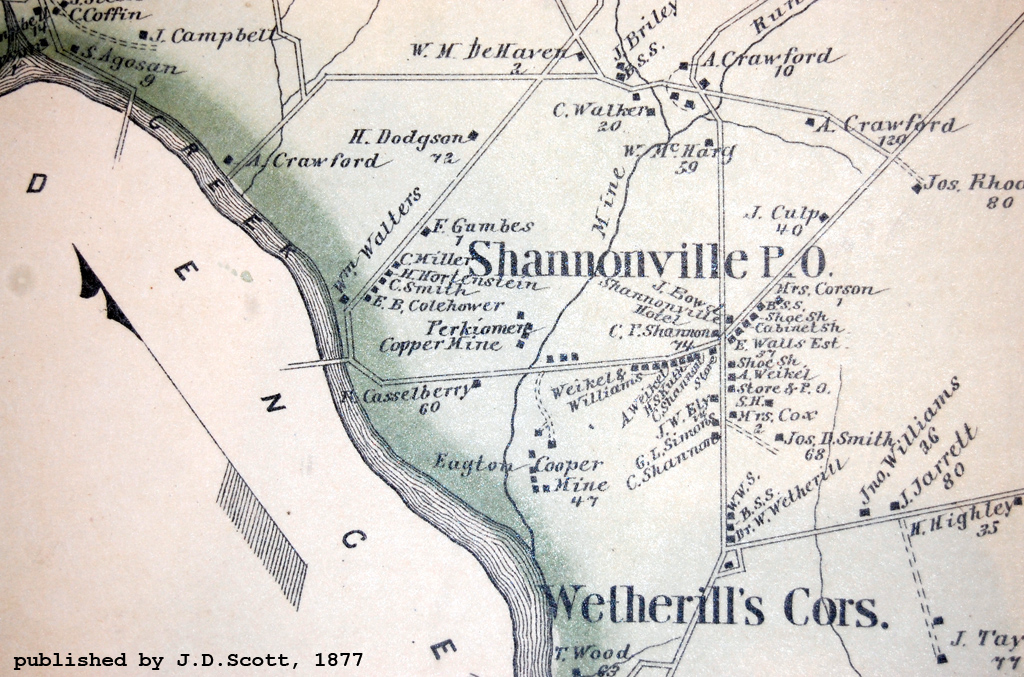
| This is an
excerpt of a map of Lower Providence Township, part of an atlas of Montgomery
County, Pennsylvania. The atlas was published in 1877 by J. D. Scott, Philadelphia. The atlas frontispeice boasts "Compiled, Drawn and Published From Personal Examinations and Surveys." This map shows the locations of the Perkiomen Copper Mine north of Egypt Road along Mine Run, and the Ecton Copper Mine on the south side. The village of Shannonville was re-named Audubon in 1899 after the circulation of a petition that was signed by a hundred persons. Not everyone thought the name change a good idea, however. Follow this link to an iconoclastic 1899 letter-to-the-editor. Follow this link to an 1882 article about the history of the copper mines at Shannonville. |
||
![]()
Follow this link to the index of articles and maps of old Shannonville / Audubon, PA.

Return to Philadelphia Trolley Tracks main page.